Knowing where to find reference maps + having a lot of free time right nowThis is crazy! How do you do these so quickly? Meanwhile it takes me a few hours to finish something moderately sized.
You are using an out of date browser. It may not display this or other websites correctly.
You should upgrade or use an alternative browser.
You should upgrade or use an alternative browser.
The VT-BAM project
- Thread starter VT45
- Start date
Africa and Southeastern Europe
(Africa could be pretty wrong since I know literally nothing about African history. Iberia is cannibalised shamelessly from Anagnod's 16th century map since I know nothing about Iberia either. Western Europe, which I also know nothing about, will also probably be mostly stolen from there)

(Africa could be pretty wrong since I know literally nothing about African history. Iberia is cannibalised shamelessly from Anagnod's 16th century map since I know nothing about Iberia either. Western Europe, which I also know nothing about, will also probably be mostly stolen from there)
Last edited:
Help yourself. Looks goodAfrica and Southeastern Europe
(Africa could be pretty wrong since I know literally nothing about African history. Iberia is cannibalised shamelessly from Anagnod's 16th century map since I know nothing about Iberia either. Western Europe, which I also know nothing about, will also probably be mostly stolen from there)
Perhaps @PecuTheGreat could help?Africa and Southeastern Europe
(Africa could be pretty wrong since I know literally nothing about African history. Iberia is cannibalised shamelessly from Anagnod's 16th century map since I know nothing about Iberia either. Western Europe, which I also know nothing about, will also probably be mostly stolen from there)
Iberia is fine, there wasn't any major changes in that era.Iberia is cannibalised shamelessly from Anagnod's 16th century map since I know nothing about Iberia either.
1820年の徳川幕府の藩国地図。 蝦夷地(北海道)は主にこのビデオに基づいています。
Tokugawa Shogunate domains and provinces map in 1820.
The Ezochi province (Hokkaido) is mostly based in this video:
The Hans (domains) are used from CHGIS database: https://chgis.fas.harvard.edu/
The Manchu Empire final map is coming soon.
(I HATE HRE, TOKUGAWA AND BRITISH RAJ!!!!!!!!)
大清东部各省地图 (I have not found a Manchu language translator)
The provinces and prefectures are used from CHGIS and updated with base subdivisions map.
The Heilong Island (Karafuto, Sakhalin) is potentially inaccurate except from the south. (Not added Russian or Japanese expeditions)
Mongolia definitely is inaccurate and is possible to the next Qing´s region to update.
As always, good luck with the HRE.I stayed awake for 31 hours making these Poland internals

1820 ᠣᠨ ᠳᠤ ᠮᠠᠨᠵᠤ ᠶᠢᠨ ᠬᠠᠭᠠᠨᠲᠤ ᠤᠯᠤᠰ ᠤᠨ ᠦᠶᠡ ᠳᠦ ᠬᠦᠷᠦᠭᠰᠡᠨ ᠥᠪᠥᠷ ᠮᠣᠩᠭ᠋ᠣᠯ᠃
Inner and outer Mongolia during the Manchu Empire in 1820.
The borders of provinces and aimags are used from CHGIS.
The banners of Outer Mongolia added (Please kill me) (it's possible inaccurate).
The Mongol aimags in the prefecture of Rehe are cannibalised shamelessly from Linbot's Eurasia Map of 1673 (Months before the Revolt of the Three Feudatories)
I hope @Blacklister doesn't mind but I made Gabon's first level administrative divisions to train myself on how to use GIMP for maps and to improve my skills, keep in mind this is my first time I used GIMP for maps so there's bound to be errors here and there.
Daicing Gurun.png
 drive.google.com
Compared to the previous two maps, this map has added corrections (basically "merging the previous two maps") and de facto controlled territories in Manchuria, Xinjiang and Taiwan.
In China Proper are the territories most influenced by the triads, Tiandihui and the White Lotus.
In Tibet and Qinghai, the tributaries were added (to differentiate them from the provinces, I colored them with the color of the indigenous reserves).
I used the OxSpace maps: https://www.alternatehistory.com/fo...rical-map-thread.404984/page-63#post-21315118
And Linbot's old map: https://www.alternatehistory.com/fo...tl-worlda-series.436046/page-64#post-20703721
The lakes were cannibalized exactly from Linbot's map of 1673. The coastline of the Bohai Sea is the same as the mentioned map, while that of Jiangsu is the same as that of CHGIS (according to Yan Xishan's video):
The Hongmen and White Lotus influenced territories is possibly inaccurate because I have not found enough information, mostly based in: https://zh.wikipedia.org/zh-cn/白蓮教 and https://zh.wikipedia.org/zh-cn/癸酉之变 and https://zh.wikipedia.org/zh-cn/洪门#其他

That conglomerate of polities in the middle of China - are those principalities Tibetan, Turkic, or Mongol?
Realy hard to say anything about your work about China, as always.Draft complete map. If you spot any inaccuracies I'd love to hear them

Duchy of Sora in Italy maybe?
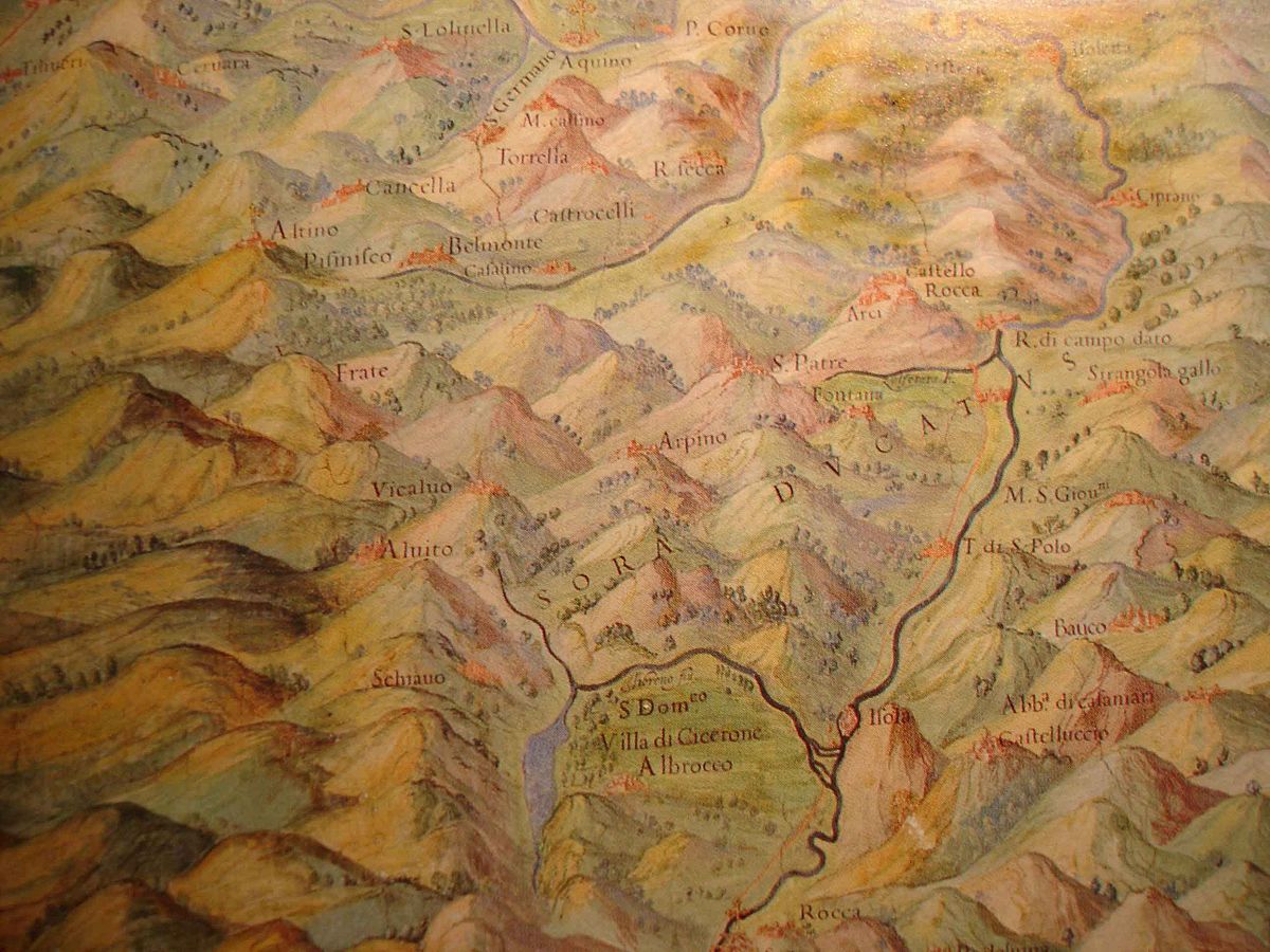
Ducato di Sora - Wikipedia
I know I've asked a while back, but does anyone here have the 1936 borders of finland and USSR, alongside the caspian sea levels for that year?
I'm working on a basic 1936 political map of europe and these two are all i need to complete the map, would appreciate if somebody could lend a hand!
I'm working on a basic 1936 political map of europe and these two are all i need to complete the map, would appreciate if somebody could lend a hand!
If you're curious, Yan Xishan is Linbot.according to Yan Xishan's video
I actually did it a while ago just for fun, but since I don't have any free time right now, I'm going to post it here.I know I've asked a while back, but does anyone here have the 1936 borders of finland and USSR, alongside the caspian sea levels for that year?
I'm working on a basic 1936 political map of europe and these two are all i need to complete the map, would appreciate if somebody could lend a hand!
Attachments

Since I'm posting this, I'm going to share my work in progress with all of you as well. But keep in mind that it's not perfect.
Attachments


Share: